UN
2 Farnhurst Road
£ 310,000
Description
We don't have a Description for this property.
- Bedrooms
- 3
- Bathrooms
- 0
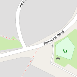

Leaflet © OpenStreetMap contributors
The heatmap indicates the level of crime in the area. The color of the heatmap indicates the crime severity and recency.
Metrics Year-on-Year
- Average area value
- 761,083.00 £Increased by 6.90 %
- Average area rental value
- 2,056.00 £/moDecreased by 3.34 %
- Est rental Yield
- 3.24 %Decreased by 9.75 %
- Crime Rate
- 50.00 %Unchanged by 0.00 %
from 711,963.00 £
from 2,127.00 £/mo
from 3.59 %
from 50.00 %
Nearby Schools
| Name | Type | Ofsted | Distance |
|---|---|---|---|
| Barnham Primary School | Academy Converter | Good | 0.53 KM |
| St Philip Howard Catholic School | Academy Converter | Outstanding | 0.85 KM |
| Walberton And Binsted Cofe Primary School | Voluntary Controlled School | Good | 2.31 KM |
| Eastergate Cofe Primary School | Voluntary Controlled School | Good | 2.77 KM |
| Yapton Ce Primary School | Voluntary Controlled School | Good | 2.87 KM |
Images
Nearby Streets
| Name | Average Price | Average Sqft | Distance |
|---|---|---|---|
| Nursery Close | £ 0 | 0 | 0.00 KM |
| Marshall Close | £ 350,000 | 0 | 0.00 KM |
| Canal Mews | £ 0 | 0 | 0.00 KM |
| Farrow Drive. Odd Nos 11-19 | £ 0 | 0 | 0.00 KM |
| Park Road | £ 475,000 | 0 | 0.00 KM |
Nearby Transport
| Name | NLC | TLC | Distance |
|---|---|---|---|
| Barnham | 5252 | BAA | 0.42 KM |
| Ford | 5258 | FOD | 6.53 KM |
| Bognor Regis | 5253 | BOG | 6.79 KM |
Nearby Listings
| Address | Price | Type | Score | Distance |
|---|---|---|---|---|
| Hedge End, Barnham, Bognor Regis PO22 | £ 350,000 | BUY | 6 / 10 | 0.13 KM |
| Hedge End, Barnham | £ 290,000 | BUY | 6 / 10 | 0.14 KM |
| Foxes Croft, Barnham | £ 310,000 | BUY | 7 / 10 | 0.15 KM |
| Stempswood Way, Barnham | £ 285,000 | BUY | 7 / 10 | 0.15 KM |
| Warren Way, Barnham | £ 220,000 | BUY | 5 / 10 | 0.18 KM |
Nearby Properties
| Address | Price | Distance |
|---|---|---|
| 23 Farnhurst Road | £ 246,500 | 0.00 KM |
| 3 Farnhurst Road | £ 235,000 | 0.00 KM |
| 20 Farnhurst Road | £ 245,000 | 0.00 KM |
| 10 Farnhurst Road | £ 56,000 | 0.00 KM |
| 22 Farnhurst Road | £ 308,000 | 0.00 KM |